Historic photos from around Amesbury, TorontoThere are a wonderful set of Toronto historic photos available online, here are all the photos that I could find from around the Amesbury area in Toronto, Ontario, Canada.List of all areas in Toronto or take a look at the historic photos by date. New! You can now access the photos by street address A subset of the photos have also been arranged by subject. Tweet |
| 1910 |  | Count Jacques de Lesseps Bleriot IX mono-plane with 3-cylinder Anzani engine, named Scarabee 114 years ago - Tuesday, July 12, 1910 - Amesbury at 59 Hearst Circle Max temp: 24.4°C - Min temp: 15.6°C (weather details) Link to archive record - Map location (From the City of Toronto Archives) |
| 1910 |  | First airplane flight at Weston - Wright Ralph Johnstone flying an Exhibition Co. 19091 Model A Transictional bi-plane 114 years ago - Tuesday, July 12, 1910 - Amesbury at 59 Hearst Circle Max temp: 24.4°C - Min temp: 15.6°C (weather details) Link to archive record - Map location (From the City of Toronto Archives) |
| 1957 | 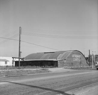 | Old De Lesseps Air Field Hanger - Aircraft Limited, Trethewey Drive near Tedder St. 67 years ago - 1957 - Amesbury at 59 Hearst Circle Link to archive record - Map location (From the Toronto Public Library Still not back as of March 2024) |
| 1957 | 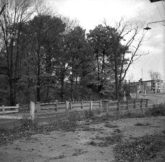 | Trethewey Dr., bridge over Black Creek, looking south 67 years ago - Sunday, October 13, 1957 - Amesbury at 121 Trethewey Drive Max temp: 16.7°C - Min temp: 4.4°C (weather details) Link to archive record - Map location (From the Toronto Public Library Still not back as of March 2024) |
| 1963 |  | Bridge on Maple Leaf Drive over Black Creek 61 years ago - 1963 - Amesbury at 41 Maple Leaf Drive Link to archive record - Map location (From the City of Toronto Archives) |