Historic Toronto photos from November 7
There are a number of great web sites that provide historic photos from around Toronto. As I was collecting them for an
interactive historic map of the city I realized that it was also interesting to find photos that were taken around the current time of the year.
If you'd like to see photos from today, you can always load this page without parameters to see the last few days worth of photos.
You can also see all the historic photos for a given neighbourhood. A subset of the photos have also been arranged by subject.
| 1924 |
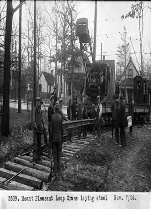 | Mount Pleasant Loop for the streetcar - now Loring-Wyle Parkette
(Categorized under: Streetcars and buses )
100 years ago - Friday, November 7, 1924
- Moore Park at 276 St Clair Ave East at Mt Pleasant Rd
Link to archive record
- Map location
(From the Library and Archives Canada) |
| 1942 |
 | Rosehill Reservoir water intake
82 years ago - Saturday, November 7, 1942
- Rosehill at 75 Rosehill Ave between St. Clair and Mt. Pleasant
Max temp: 7.8°C - Min temp: 1.1°C (weather details)
Link to archive record
- Map location
(From the City of Toronto Archives) |
| 1947 |
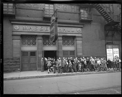 | People lined up along Shuter Street outside Massey Hall
(Categorized under: Massey Hall )
77 years ago - Friday, November 7, 1947
- Garden District at Shuter Street west of Victoria St
Link to archive record
- Map location
(From Archives of Ontario) |
| 1973 |
 | Looking west from Yonge Street to Trinity Square (Now the Eaton Centre)
51 years ago - Wednesday, November 7, 1973
- Downtown
Max temp: 6.7°C - Min temp: 1.1°C (weather details)
Link to archive record
- Map location
(From the City of Toronto Archives) |
| 1981 |
 | Looking north on Bond Street with Bond Street Temple in the foreground, and St. Georges Greek Orthodox church farther north
43 years ago - Saturday, November 7, 1981
- Ryerson at 103 Bond Street (approx.) n.e corner at Dundas Street East
Link to archive record
- Map location
(From the City of Toronto Archives) |
| | |  Previous day with photos - next day with photos Previous day with photos - next day with photos 
 Be sure to subscribe to the RSS feed here for regular updates. Be sure to subscribe to the RSS feed here for regular updates.
|