Historic Toronto photos from July 9There are a number of great web sites that provide historic photos from around Toronto. As I was collecting them for an interactive historic map of the city I realized that it was also interesting to find photos that were taken around the current time of the year.If you'd like to see photos from today, you can always load this page without parameters to see the last few days worth of photos. You can also see all the historic photos for a given neighbourhood. A subset of the photos have also been arranged by subject. Tweet |
| 1914 |  | Horse and women with umbrellas at Christie St. north over Davenport Road 110 years ago - Thursday, July 9, 1914 - Davenport Max temp: 28.3°C - Min temp: 19.4°C (weather details) Link to archive record - Map location (From the City of Toronto Archives) |
| 1924 | 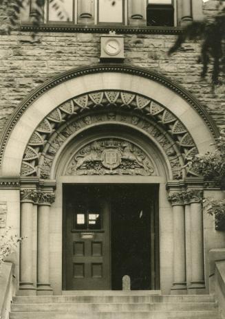 | The 1809 Dominion Meteorological Building designed by Toronto architects Burke and Horwood (now the Munk school) 100 years ago - Wednesday, July 9, 1924 - University of Toronto (U of T) at 315 Bloor Street West s.w. corner at Devonshire Place Link to archive record - Map location (From the Toronto Public Library Still not back as of March 2024) |
| 1931 |  | St. Clair Avenue west to Keele Street 93 years ago - Thursday, July 9, 1931 - The Junction Max temp: 25.6°C - Min temp: 13.9°C (weather details) Link to archive record - Map location (From the City of Toronto Archives) |