Historic Toronto photos from October 13
There are a number of great web sites that provide historic photos from around Toronto. As I was collecting them for an
interactive historic map of the city I realized that it was also interesting to find photos that were taken around the current time of the year.
If you'd like to see photos from today, you can always load this page without parameters to see the last few days worth of photos.
You can also see all the historic photos for a given neighbourhood. A subset of the photos have also been arranged by subject.
| 1899 |
 | Old west abutment, Queen Street bridge over Don River
(Categorized under: Queen Don bridge )
125 years ago - Friday, October 13, 1899
- Riverside-South Riverdale at 578 Queen Street East
Link to archive record
- Map location
(From the City of Toronto Archives) |
| 1914 |
 | St. Clair Avenue west to Bathurst Street after fill
110 years ago - Tuesday, October 13, 1914
- Casa Loma at 490 St Clair Ave West
Max temp: 9.4°C - Min temp: 3.9°C (weather details)
Link to archive record
- Map location
(From the City of Toronto Archives) |
| 1915 |
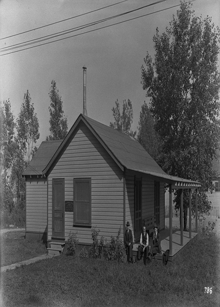 | P.W.C. Dining cottage - Fishermans Island
109 years ago - Wednesday, October 13, 1915
- Cherry Beach at 1 Cherry Street
Link to archive record
- Map location
(From the Library and Archives Canada) |
| 1957 |
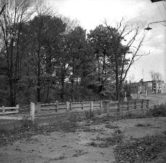 | Trethewey Dr., bridge over Black Creek, looking south
67 years ago - Sunday, October 13, 1957
- Amesbury at 121 Trethewey Drive
Max temp: 16.7°C - Min temp: 4.4°C (weather details)
Link to archive record
- Map location
(From the Toronto Public Library Still not back as of March 2024) |
| | |  Previous day with photos - next day with photos Previous day with photos - next day with photos 
 Be sure to subscribe to the RSS feed here for regular updates. Be sure to subscribe to the RSS feed here for regular updates.
|