Historic photos from around Lawrence Park, Toronto
There are a wonderful set of Toronto historic photos available online, here are all the photos that I could find from around the Lawrence Park area in Toronto, Ontario, Canada.List of all areas in Toronto or take a look at the historic photos by date. New! You can now access the photos by street address A subset of the photos have also been arranged by subject. Tweet
| 1910 |  | Buena Vista, 35 St. Edmund Dr (Originally C. and A. Dinnick House, Chadwick and Beckett Architects, ca. 1909) 114 years ago - 1910 - Lawrence park at 35 Saint Edmunds Drive Link to archive record - Map location (From Archives of Ontario) |
| 1910 | 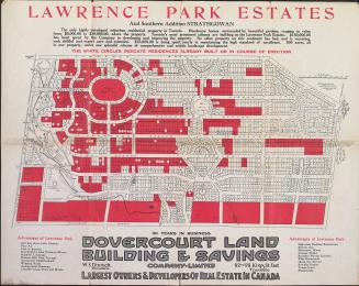 | Promotional map of Lawrence Park estates and southern addition Strathgowan 114 years ago - 1910 - Lawrence Park Link to archive record - Map location (From the Toronto Public Library Still not back as of March 2024) |
| 1910 |  | Flagcourt Gardens at 1 St. Edmunds Drive, John Firstbrook house 114 years ago - 1910 - Lawrence Park at 1 Saint Edmunds Drive Link to archive record - Map location (From Archives of Ontario) |
| 1912 |  | Construction of homes on the south-east corner of Lympstone Ave and St. Edmunds Drive 112 years ago - 1912 - Lawrence park at 1 Saint Edmunds Drive Link to archive record - Map location (From Archives of Ontario) |
| 1922 |  | Track construction and horses on Yonge St, at Lawrence Ave, looking north 102 years ago - Thursday, October 19, 1922 - Lawrence Park at 3091 Yonge Street Max temp: 12.2°C - Min temp: -1.7°C (weather details) Link to archive record - Map location (From the City of Toronto Archives) |
| 1923 | 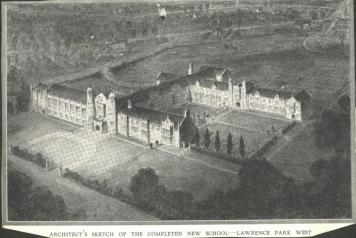 | Architects aerial sketch by the firm Chapman and Oxley of Havergal's planned 'New School' in Lawrence Park West
(Categorized under: Havergal college ) 101 years ago - 1923 - Lawrence Park at 1451 Avenue Road Link to archive record - Map location |
| 1926 | 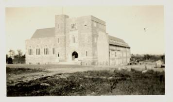 | Mid the mud - construction of Havergal building on Avenue Road - muddy clay didn't lead easily to lush lawns
(Categorized under: Havergal college ) 98 years ago - 1926 - Lawrence Park at 1451 Avenue Road Link to archive record - Map location |
| 1926 | 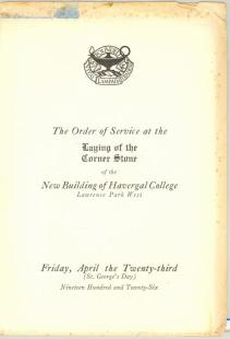 | Programme from Cornerstone laying of new Havergal building on Avenue Road
(Categorized under: Havergal college ) 98 years ago - Friday, April 23, 1926 - Lawrence Park at 1451 Avenue Road Link to archive record - Map location |
| 1927 | 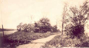 | Path to Havergal's 'New School' - maybe heading south from Lawrence Ave?
(Categorized under: Havergal college ) 97 years ago - 1927 - Lawrence Park at 1451 Avenue Road Link to archive record - Map location |
| 1928 | 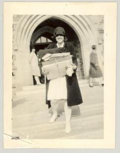 | Boarder leaving Havergal for home - Parents had to approve list of people their daughters could write to or visit, and phone calls may have been monitored as well. (Categorized under: Havergal college ) 96 years ago - 1928 - Lawrence Park at 1451 Avenue Road Link to archive record - Map location |
| 1929 | 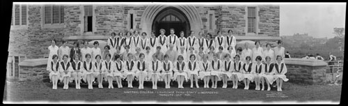 | Havergal College - Lawrence Park - panoramic photo of the staff and boarders (Categorized under: Havergal college ) 95 years ago - 1929 - Lawrence Park at 1451 Avenue Road just south of Lawrence Ave. West Link to archive record - Map location (From Archives of Ontario) |
| 1930 | 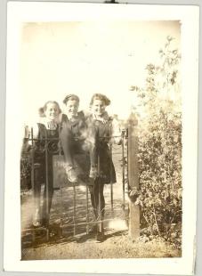 | Havergal College sign on gate - Avenue Road circa 1930 (Categorized under: Ornamental gate --- Havergal college ) 94 years ago - 1930 - Lawrence Park at 1451 Avenue Road Link to archive record - Map location |
| 1933 | 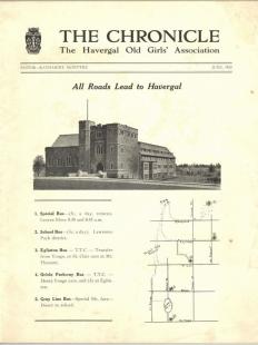 | All roads lead to Havergal - bus routes to the school from Avenue and Bloor, or on the TTC, etc. south wing not yet added (Categorized under: Havergal college ) 91 years ago - Thursday, June 1, 1933 - Lawrence Park at 1451 Avenue Road Link to archive record - Map location |
| 1933 |  | Lawrence Park Ravine - north of Lympstone Avenue 91 years ago - Friday, November 3, 1933 - Lawrence Park at 3055 Yonge Street Max temp: 10.0°C - Min temp: 3.9°C (weather details) Link to archive record - Map location (From the City of Toronto Archives) |
| 1933 |  | Lawrence Park Ravine - north of Lympstone Avenue 91 years ago - Friday, November 3, 1933 - Lawrence Park at 3055 Yonge Street Max temp: 10.0°C - Min temp: 3.9°C (weather details) Link to archive record - Map location (From the City of Toronto Archives) |
| 1933 |  | Lawrence Park Ravine - south of Lympstone 91 years ago - Friday, November 3, 1933 - Lawrence Park at 3055 Yonge Street Max temp: 10.0°C - Min temp: 3.9°C (weather details) Link to archive record - Map location (From the City of Toronto Archives) |
| 1937 | 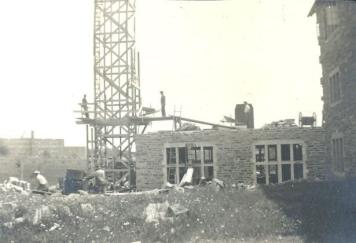 | Lawrence Park Collegiate (1936) in background while new wing being added to Havergal thanks to funding from the Leonard Foundation (Categorized under: Schools --- Havergal college ) 87 years ago - 1937 - Lawrence Park at 1451 Avenue Road Link to archive record - Map location |
| 1937 | 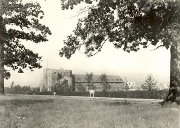 | Approaching Havergal College northbound near Avenue Road - Lawrence Park Collegiate in background (Categorized under: Havergal college ) 87 years ago - 1937 - Lawrence Park at 1451 Avenue Road Link to archive record - Map location |
| 1939 | 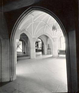 | Interior of Havergal - front entrance rotunda leading into the Assembly Hall (Categorized under: Havergal college ) 85 years ago - 1939 - Lawrence Park at 1451 Avenue Road Link to archive record - Map location |
| 1939 | 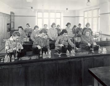 | Students at work in the Havergal Chemistry Lab (Categorized under: Havergal college ) 85 years ago - 1939 - Lawrence Park at 1451 Avenue Road Link to archive record - Map location |
| 1939 | 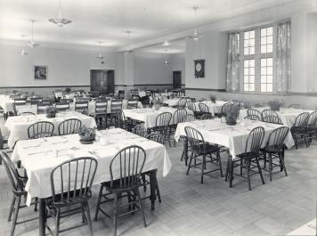 | Interior of Havergal - student dining hall (Categorized under: Havergal college ) 85 years ago - 1939 - Lawrence Park at 1451 Avenue Road Link to archive record - Map location |
| 1939 | 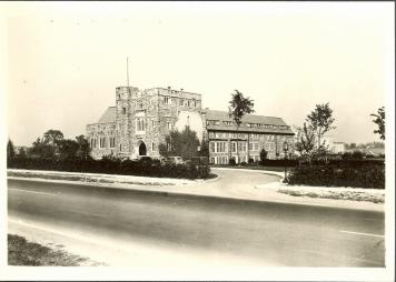 | Front entrance from Avenue road to Havegal Girls School (Categorized under: Havergal college ) 85 years ago - 1939 - Lawrence Park at 1451 Avenue Road Link to archive record - Map location |
| 1939 | 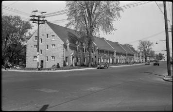 | Avenue Road, looking north from Glencairn Avenue (towards Havergal College)
85 years ago - Friday, July 7, 1939 - Lawrence Park at 1340 Avenue Road just north of Glencairn Avenue Link to archive record - Map location |
| 1941 | 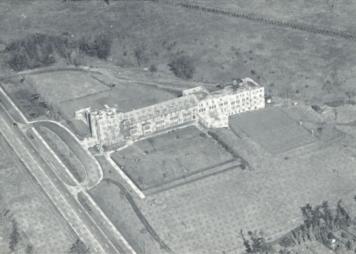 | Aerial view of Havergal College and area - path in the top right eventually where Rosewell Avenue is now (Categorized under: Havergal college ) 83 years ago - 1941 - Lawrence Park at 1451 Avenue Road Link to archive record - Map location |
| 1944 | 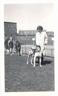 | Lawrence Park Collegiate as seen in the distance from the Havergal College tennis courts (Categorized under: Schools --- Havergal college ) 80 years ago - 1944 - Lawrence Park at 1451 Avenue Road Link to archive record - Map location |
| 1947 |  | Lawrence Avenue, 150 feet west of Yonge looking East 77 years ago - Wednesday, January 15, 1947 - Lawrence Park at 36 Lawrence Avenue West Max temp: 4.4°C - Min temp: 1.7°C (weather details) Link to archive record - Map location (From the City of Toronto Archives) |
| 1950 | Court garden designed by J. Austin Floyd, Yonge Street at Lawrence Park 74 years ago - 1950 - Lawrence Park at 3012 Yonge Street Link to archive record - Map location (From the Library and Archives Canada) |
|
| 1954 | 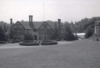 | Edgar A. Eaton house, Blythwood Rd., s.w. corner Bayview Ave. (Categorized under: Edgar-a-eaton-house ) 70 years ago - 1954 - Lawrence Park at 1 Lauren Court Link to archive record - Map location (From the Toronto Public Library Still not back as of March 2024) |
| 1954 | 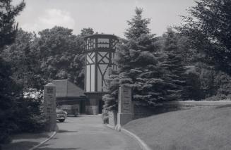 | Gates, and stables with tower at Edgar A. Eaton, house, Blythwood Rd., s.w. corner Bayview Ave. (Categorized under: Edgar-a-eaton-house ) 70 years ago - 1954 - Lawrence Park at 1 Lauren Court Link to archive record - Map location (From the Toronto Public Library Still not back as of March 2024) |
| 1954 | 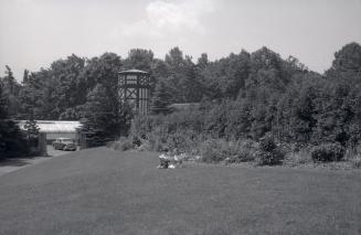 | Girls in front of garden and stables - Edgar A. Eaton house, Blythwood Rd., s.w. corner Bayview Ave. (Categorized under: Edgar-a-eaton-house ) 70 years ago - 1954 - Lawrence Park at 1 Lauren Court Link to archive record - Map location (From the Toronto Public Library Still not back as of March 2024) |
| 1954 | 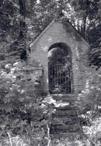 | Stone gate in the trees - Edgar A. Eaton, house, Blythwood Rd., s.w. corner Bayview Ave. (Categorized under: Edgar-a-eaton-house --- Ornamental gate ) 70 years ago - 1954 - Lawrence Park at 1 Lauren Court Link to archive record - Map location (From the Toronto Public Library Still not back as of March 2024) |
| 1961 | 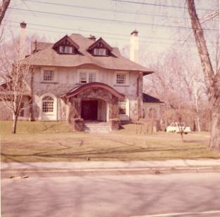 | Lytton House - east side of Avenue Road between park and Glencairn Ave. - used as residence for Havergal College (Categorized under: Havergal college ) 63 years ago - 1961 - Lawrence Park at 1307 Avenue Road Link to archive record - Map location |
| 1961 | 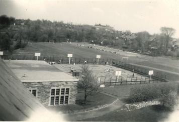 | John Ross Robertson elementory school as seen in the distance from the roof of Havergal College and their playing fields (Categorized under: Schools --- Havergal college ) 63 years ago - 1961 - Lawrence Park at 1451 Avenue Road Link to archive record - Map location |
| 1995 | 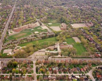 | Glenview Junior High, LPCI, John Ross Robertson and Havergal - aerial view (Categorized under: Schools --- Havergal college ) 29 years ago - 1995 - Lawrence Park at 460 Rosewell Ave Link to archive record - Map location |