Historic photos from around Bridle Path, TorontoThe Bridle Path is the most affluent neighbourhood in Toronto, and across all of Canada, with an average household net worth of $22.27 million CDN. The building of the Bayview Bridge over the west Don River opened up the area to development in the early 1930s. Some of the plans included horse trails, hence the name (although the area is often misspelled as "The Bridal Path." Ed note: Even as a lifelong resident of Toronto I had this mistake here until a reader e-mailed me a correction. Thanks Nancy W.!)Forsey Page, E.P. Taylor, and his business partner George Montegu Black, Jr (father of Conrad Black) were early residents and land developers. List of all areas in Toronto or take a look at the historic photos by date. New! You can now access the photos by street address A subset of the photos have also been arranged by subject. Tweet |
| 1926 |  | E.R. Wood (right) with daughter and her husband Murray Fleming (unknown location) 98 years ago - 1926 - Bridle Path Link to archive record - Map location (From the City of Toronto Archives) |
| 1930 |  | Aerial view of the Bridle Path - north end of Bayview to the mid left, Sifton\ 94 years ago - 1930 - Bridle Path Link to archive record - Map location (From the City of Toronto Archives) |
| 1945 | 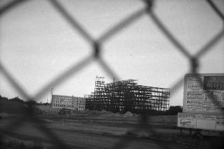 | Construction of Sunnybrook Hospital, Bayview Ave. at Blythwood Rd. 79 years ago - 1945 - Bridle Path at 2075 Bayview Ave Link to archive record - Map location (From the Toronto Public Library Still not back as of March 2024) |
| 1946 | Entrance to the newly constructed Sunnybrook Hospital 78 years ago - Thursday, September 26, 1946 - Bridle Path at 2075 Bayview Ave Link to archive record - Map location (From York University Archives) |
|
| 1947 | 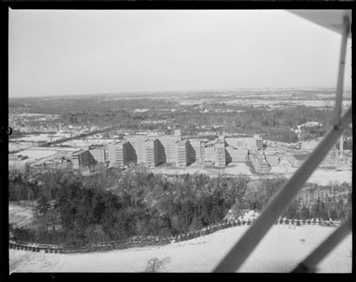 | Aerial view of Sunnybrook Hospital 77 years ago - Tuesday, December 30, 1947 - Bridle Path at 2075 Bayview Ave Max temp: -6.7°C - Min temp: -13.9°C (weather details) Link to archive record - Map location (From Archives of Ontario) |
| 1948 | | Red Cross Building at Sunnybrook Hospital (flag at half-mast?) 76 years ago - Tuesday, May 18, 1948 - Bridle Path at 2075 Bayview Ave south of Lawrence Ave. East Max temp: 15.6°C - Min temp: 10.6°C (weather details) Link to archive record - Map location (From Archives of Ontario) |
| 1955 | 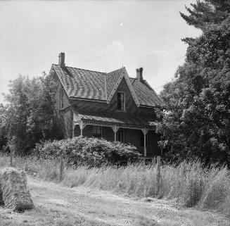 | James Muirhead house and farm, Park Lane Circle, near The Bridle Path? 69 years ago - Sunday, July 3, 1955 - Bridle Path Max temp: 30.0°C - Min temp: 18.9°C (weather details) Link to archive record - Map location (From the Toronto Public Library Still not back as of March 2024) |
| 1955 | 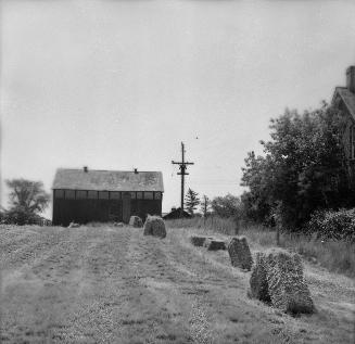 | Farm buildings at Jame Muirhead house, Park Lane Circle, near The Bridle Path? 69 years ago - Sunday, July 3, 1955 - Bridle Path Max temp: 30.0°C - Min temp: 18.9°C (weather details) Link to archive record - Map location (From the Toronto Public Library Still not back as of March 2024) |
| 1956 |  | Training stables Windfields Farm - once the home of E.P. Taylor, now the Canadian Film Centre (CFC) 68 years ago - Tuesday, November 27, 1956 - Bridle Path at 2489 Bayview Ave Max temp: 1.1°C - Min temp: -2.8°C - 4.0cm of snow on the ground (weather details) Link to archive record - Map location (From the City of Toronto Archives) |
| 1961 |  | 7 photos of the construction of the Lawrence Avenue East overpass at Bayview Avenue 63 years ago - 1961 - Bridle Path at 2293 Bayview Ave Link to archive record - Map location (From the City of Toronto Archives) |
| 1961 | 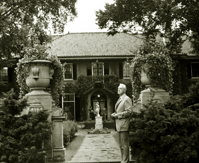 | Murray Ross standing at the gates of Glendon Hall, York University 63 years ago - Friday, September 15, 1961 - Bridle Path at 2275 Bayview Ave Max temp: 18.3°C - Min temp: 11.1°C (weather details) Link to archive record - Map location (From York University Archives) |
| 1980 | 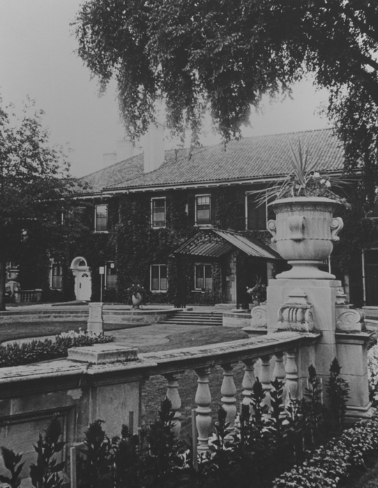 | Glendon Hall - built 1924 - former country estate of Edward Rogers Wood 44 years ago - 1980 - Bridle Path at 2275 Bayview Ave Link to archive record - Map location (From York University Archives) |