Historic Toronto photos from June 3There are a number of great web sites that provide historic photos from around Toronto. As I was collecting them for an interactive historic map of the city I realized that it was also interesting to find photos that were taken around the current time of the year.If you'd like to see photos from today, you can always load this page without parameters to see the last few days worth of photos. You can also see all the historic photos for a given neighbourhood. A subset of the photos have also been arranged by subject. Tweet |
| 1894 | 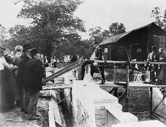 | Laying the cornerstone for the east wing of Trinity College in Trinity Bellwoods park 130 years ago - Sunday, June 3, 1894 - Trinity Bellwoods Max temp: 20.0°C - Min temp: 7.2°C (weather details) Link to archive record - Map location (From the Toronto Public Library Still not back as of March 2024) |
| 1908 |  | Island in flood, 12 St. Andrews Avenue 116 years ago - Wednesday, June 3, 1908 - Toronto Island Max temp: 24.4°C - Min temp: 6.1°C (weather details) Link to archive record - Map location (From the City of Toronto Archives) |
| 1935 |  | Condemned house - 9-11 Britian Street just south of Queen Street East 89 years ago - Monday, June 3, 1935 - Moss Park at 9 Britian Street Max temp: 23.9°C - Min temp: 13.9°C (weather details) Link to archive record - Map location (From the City of Toronto Archives) |
| 1988 | 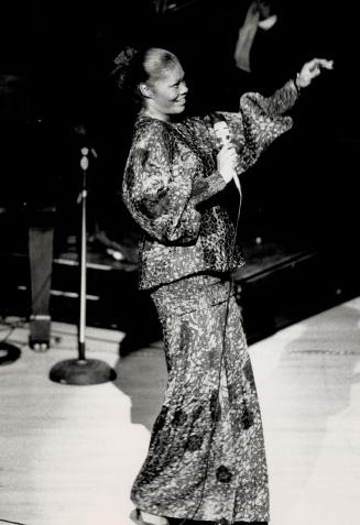 | Roy Thompson Hall - Dionne Warwick performing live on stage in Toronto in 1988 (Categorized under: Live music ) 36 years ago - Friday, June 3, 1988 - King Street West at 60 Simcoe Street s.w. corner at King Street West Link to archive record - Map location (From the Toronto Public Library Still not back as of March 2024) |
| 2013 | 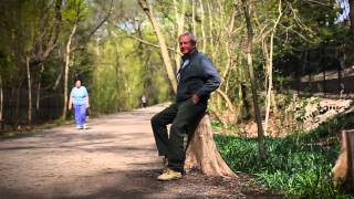 | Robert Bateman: Memories of the Beltline (Categorized under: Belt Line trail ) 11 years ago - Monday, June 3, 2013 - Forest Hill at 281 Chaplain Crescent just south east of Russell Hill Road Link to archive record - Map location |